Gratteri: history of a thousand-year old village in the Madonie mountains
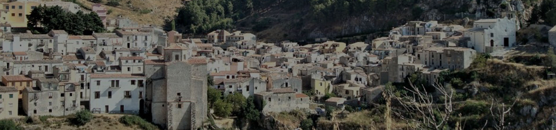
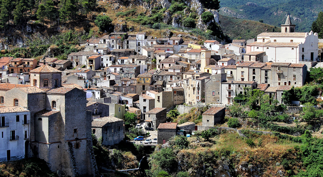
Gratteri is a municipality of about 900 inhabitants in the province of Palermo that is part of the Madonie Park. A small town in the Madonie, Gratteri overlooks the Tyrrhenian coast from the top of the mountainous geographical region south-west of Cefalù.
Its municipal territory, included in the northern area of the Madonie Park, borders with those of the municipalities of Cefalù (north and north-west), Lascari (north-west), Collesano (west and south-west) and Isnello (east and south-east).
Various hypotheses have been put forward on the origin of the toponym: according to Maurolico, ‘the town of Gratteri, near Cefalù, took its name from the mountain called Cratos‘. Cratos or Craton would therefore be the toponym attributed to the local mountains. Alternatively, the name could derive from the Crati, the stream that descends from Pizzo Dipilo and crosses the town.
The first traces of frequentation in the area probably date back to the late Bronze Age or early Iron Age, as evidenced by the discovery of a ‘storehouse’ with eight flat axes with more or less raised edges; two eye axes with curved feathers; and a large ring, currently kept in the Palermo Museum.
The finding could indicate the existence of an emporium for commercial exchanges between the mountain settlements and neighbouring territories.
Philistus (4th century BC), mentions a centre of ‘Craterius oppidum Siciliane’, which could be identified in the territory of Gratteri. As regards the period between the 1st century AD and the Muslim invasion, the only clue is represented by the finding of a Roman coin from the 2nd century in contrada Suro.
The first information about the settlement dates back to the period of Arab domination (10th-12th century). It is probable that an initial settlement developed around the 9th century following the construction of a Muslim garrison that later developed in order to control the territory.
Several place names in the area are of Arab origin, and there are also some buildings with a typically Arab layout.
In 1059, the Normans arrived with Robert Guiscard and Count Roger of Altavilla gave a new economic, social, legal and administrative structure to Sicily, which was characterised by the presence of different ethnic groups, by resorting to monastic orders.
The abbeys of Sant’Anastasia and San Giorgio and the construction of the churches of Sant’Elia, San Nicolò and Sant’Icono date from this period. Together with numerous villages and towns of the Val Demone, Gratteri was subjected first to the bishopric of Troina, then to the diocese of Messina.
The first lord of Gratteri was a certain Guglielmo, recorded in a diploma of Countess Adelasia of 1112. Subsequently, the fiefdom passed to the lords of Monforte until 1250, when the lands of Gratteri and Isnello were assigned by will of Manfredi, son of Frederick II, to the Metropolitan Church of Palermo.
The fiefdom later passed to the Ventimiglia family, who came into conflict with the bishop of Cefalù for possession of the Roccella charters, due to its strategic and economic importance. Confiscated by Charles of Anjou, Gratteri was granted during the War of the Vespers to Guglielmo of Mosterio.
During the Aragonese period Gratteri witnessed the wars between the troops of King Peter II – who in 1338 granted it together with Brucato and Collesano to the royal Curia – and the Sicilian army, led by the Ventimiglia family.
The latter, who in this circumstance obtained the support of the inhabitants of Gratteri, took back the barony. From the 15th century onwards, from the reign of Alfonso of Aragon, in a changed socio-economic and political panorama, the barony of Gratteri of the Ventimiglias began, which was to characterise the life of the community in all its aspects for centuries.
According to a description by Benedetto Passafiume in 1645, the town was at this time divided into an older core, with a castle and surrounded by walls accessible through three gates, which corresponds to the medieval centre, and a newer core, which corresponds to the later expansion from the 15th century onwards.
The medieval centre was built around the lost castle with a rather irregular road layout, some of which is still preserved. From the castle, built on the fortress of San Vito, it was possible to control the territory below, as far as the coast. The town walls have also disappeared, but it is possible to reconstruct the eastern route along the edge of the stream: the three gates correspond to the three bridges that gave access to the town (the old or ‘sottano’ (‘below’) bridge, today known as the Silvio bridge, the Fantina or ‘di mezzo’ (‘middle’) bridge and the new or ‘soprano’ (‘upper’) bridge), built at different times during the expansion of the medieval town.
The main access route to the town was the one coming from the county of Collesano, with the last part of the route carved into the rock of the western slope of the fortress, and heading towards Gibilmanna and Cefalù. The main urban axis was the ‘Via della Santa’ (now Via Carlo Alberto), between the castle and the church of San Nicolò.
Secondary streets, often with steps, branched off from this road and still converge today in irregular widenings and blind alleys. The names of the medieval quarters (‘di la scala’, ‘di San Vito’, ‘di lo castello’, ‘di la petra’, ‘di la Santa’, ‘di la terra vecchia’, ‘di la bucciria vecchia’, ‘di San Nicolò’ and ‘di la porta ‘ranni’) can also be found in the 16th-century ‘riveli’ (parish records).
In the second half of the 13th century, the development of the area around the church of San Leonardo seems to have taken place. New churches were built (San Filippo in the ‘di la petra’ district, San Giuseppe in the castle area and Santa Eufemia, now in the territory of Lascari, the small church of San Biagio on the border with the territory of Cefalù and the small rural church of San Teodoro, in the district of the same name).
The church of San Michele Arcangelo or ‘maggiore ecclesia’, built in the area of the castle in the mid-14th century, became the new centre of the village. In the second half of the 15th century, the construction of the church of San Sebastiano gave rise to a new expansion of the settlement to the south-east of the castle. The neighbourhoods of ‘lu sciumi’, ‘di Fantina’ and ‘di San Sebastiano’ were born, connected to the medieval core by three bridges. The small Church of the Crucifix and the Church of Santa Caterina, both in the ‘Scala’ quarter, can probably be attributed to the end of the century.
From the 16th century onwards, the arrival of the Friars Minor Conventual, with the construction of the convent (1500) adjacent to the church of Santa Maria di Gesù, led to a new expansion of the town towards the north-east, in the ‘new part’ mentioned by Passafiume in his description.
Bibliografia:
DI FRANCESCA PINA, Gratteri, Palermo, Flaccovio, 2000
SCELSI ISIDORO, Gratteri, storia, cultura, tradizioni, Palermo 1981, rist. Cefalù, Tip. Valenziano 2008.
Wikipedia.it